 KEPLER
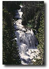
CASCADES
This set of multiple
cascades and waterfalls, 100-150 feet high, is located on the
Firehole River above Old Faithful. It was named in 1881 by park
superintendent P.W. Norris for Kepler Hoyt, a twelve-year-old
boy who toured Yellowstone that year with his father, Governor
John Hoyt of Wyoming Territory. These cascades are easily viewed.
There is a parking area and overlook alongside the highway.
 CASCADES
OF THE FIREHOLE
A popular series of
cascades is located at the head of Firehole Canyon just below
an island which was used by Yellowstone's earliest visitors
as a camping spot. These cascades can be viewed at the end of
the one-way Firehole Canyon Drive.
 FIREHOLE
FALLS
It is not known who
actually named Firehole Falls, but members of the 1872 Hayden
Survey took note of it. The falls is located in the spectacular
Firehole Canyon, a place characterized by jumbled cliffs of
rhyolite breccia. Motorists can see its forty-foot drop from
a turnout and parking area on the Firehole Canyon Drive. (Parking
Available) Numerous unnamed cascades are also visible downstream.
 |

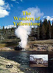
The
Wonders of Yellowstone
The
latest release from Yellowstone Media Group. A comprehensive
DVD on all the wonders of Yellowstone brought to you as
a video travel guide. A must have when visiting the park
or just as a great gift/souvenir to remember your visit.
98 minutes
Price....
$24.95 (plus $5.30 shipping - no sales tax)
Available
Online Now |
GIBBON FALLS
William Henry Jackson
and John Merle Coulter of the second Hayden survey discovered this waterfall of the Gibbon River,
height 84 feet, in 1872. The name for it seems to have early
come into general usage from the river. In addition, several
early park maps used the name "First Cañon Falls."
A viewpoint of
Gibbon Falls and a small parking area is located alongside the
highway between Madison and Norris Junctions.
 VIRGINIA
CASCADE
Virginia Cascade can
be found between Norris and Canyon on the Gibbon River. Ed Lamartine
gave the name in 1886. Lamartine was the foreman in charge of
building the first road through the area. The feature entranced
early visitors who passed Virginia Cascade on the dusty stage
road. These visitors saw the falls from its bottom, and that
is probably still the best viewpoint.
 LOWER
FALLS OF THE YELLOWSTONE RIVER
This cataract, long
believed to be the park's tallest at 308 feet, is also one of
the great waterfalls of the North American continent. It has
probably had more words written about it than any other park
waterfall. Nearly half of the historic visitor reactions to
Yellowstone waterfalls that have been collected were written
about this cataract and its upstream companion, Upper Falls.
Traveling prospectors
of the 1860s brought stories back to Montana Territory of a
huge waterfall on the Yellowstone River that appeared in frontier
newspapers. One such article claimed the falls was "thousands
of feet" high while another averred fifteen hundred and
called it "the most sublime spot on earth."
The 1869 Folsom
expedition gave the name to both of the great Yellowstone waterfalls
from their positions on the river, and attempted to measure
their heights. Their map carried the notation "Lower Falls
350 ft." However early visitors also referred to it as
the "Great Fall" or "Grand Fall" of the
Yellowstone,
Today the park
has constructed numerous, accessible viewpoints in which to
photograph Lower Falls.
 UPPER
FALLS OF THE YELLOWSTONE RIVER
Upper Falls is the
upstream of the two most famous Yellowstone waterfalls. It is
109 feet high. Jim Bridger himself was familiar with this falls,
as old-timer James Gemmell has stated that in 1846, he and Bridger
visited it. Viewpoints of Upper Falls are accessible on both
sides of the canyon, and are a favorite of Yellowstone visitors.
 CRYSTAL
FALLS
A striking, three-step
waterfall of Cascade Creek, height 129 feet, may be seen from
Uncle Tom's Point if one looks to the right (north) of Upper
Falls. It was named Crystal Falls in 1870 by Cornelius Hedges
of the Washburn expedition. A pool above the falls was noticed
early and given the name Grotto Pool by park superintendent
P.W. Norris.
Crystal Falls
is one of the most pleasant surprises in the Canyon area as
it is generally overlooked. Walking to Crystal Falls along the
North Rim Trail is an enjoyable escape for folks of all ages.
 LEWIS
FALLS
Lewis Falls is a thirty-foot-high
drop of the Lewis River about a mile downstream from Lewis Lake.
The area was explored in 1872 by the Hayden survey.
Due to its location
above a highway bridge crossing of the Lewis River, Lewis Falls
is one of the park's most photographed waterfalls. It is easily
seen from one's car window when driving the south entrance road,
and there is a pullout and parking area nearby.
MOOSE FALLS
Moose Falls on Crawfish
Creek is thirty feet high and was named in 1885 by the Arnold
Hague survey in accordance with the philosophy of naming natural
features after local fauna. A pullout on the south entrance
road just a few hundred yards inside the park's south entrance
offers easy access for visitors. The falls can be viewed from
either side of the stream if one uses the very short trails
provided.
 RUSTIC
FALLS
Named in 1879 by park
superintendent P.W. Norris, Rustic Falls on Glen Creek is 47
feet high. Members of the Hayden survey saw it in 1871, and
Joshua Crissman photographed it in 1872.
The nearby Golden
Gate Canyon and Golden Gate Bridge are closely connected to
Rustic Falls. The bridge has been rebuilt three times since
the original wooden one was erected in 1885, and the canyon
received its name from the golden lichens which color its walls.
 UNDINE
FALLS
This three-step waterfall
of Lava Creek, height sixty feet, appeared on the cover of National
Geographic Magazine for July 1977. It is a multi-step falls
that consists of three plunges which can be seen from an overlook
on the main road.
Originally called
"East Gardner Falls," "Cascade Falls of the East
Gardiner," or "Gardiner River Falls," Undine
received its present name in 1885 from geologist Arnold Hague.
Undine (Webster says it is pronounced UN deen) was named for
wise, usually female water spirits from German mythology who
lived around waterfalls and who could gain souls by marrying
mortal men.
 WRAITH
FALLS
Wraith Falls, a 100-foot
gently sloping cascade on Lupine Creek was named in 1885 by
members of the Hague parties of the U.S. Geological Survey.
Although there is no documentation of the reason for this name,
the survey members were apparently reminded of a ghost or spectre
in the gossamer rivulets of white water here. There is an easy,
half-mile-long trail to this falls, which takes hikers to an
overlook that was moved and revamped in the early 1990s. Signs
mark the trailhead on the Mammoth-Tower Road about a mile east
of the Lava Creek Picnic Area. Keen eyed visitors can even spot
this falls in the distance from the upper terraces at Mammoth.
 TOWER
FALL
This "chastely-beautiful"
waterfall of Tower Creek, height 132 feet, was called "Little
Falls" by fur trappers. Fur trapper Jim Bridger himself
gave that information to Father Jean DeSmet who showed it on
an 1851 map.
Tower Fall was
named in 1870 by members of the Washburn party, probably Samuel
Hauser, who wrote in his diary: "Campt near the most beautiful
falls--I ever saw--I named them 'Tower falls'--from the towers
and pinnacles that surround them."
Today the Tower
Fall area is one of the most congested areas of the park. There
is a parking area on the road between Roosevelt and Canyon,
but it gets quite crowded in mid-summer. The walk to the overlook
is roughly 100 yards, while a more strenuous hike will take
the visitor to the base of the falls.
 LOST
CREEK FALLS
Located on Lost Creek
just one-quarter mile above Roosevelt Lodge, Lost Creek Falls
is forty feet high and an easy walk for Roosevelt visitors.
The tranquility of this plunge-type falls is probably its most
attractive feature.
This falls is
especially affected by its loss of water in the autumn. It offers
an inviting treat for those willing to take the short walk to
view the sheer, dark-colored wall over which the water drops.
The easy, well maintained trail ends about 100 yards short of
the falls but provides a fine view. Travel beyond the trail
is unsteady due to loose footing and steep slopes.

