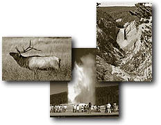
%20of%20xcountrybar.JPG)
Yellowstone River Trail
Length to Gardiner, Montana
from:
Hellroaring Gravel Pit Trailhead 16.75 miles, one way.
Hellroaring Ford 14.75 miles, one way.
Cottonwood Creek 11.1 miles, one way.
Blacktail Bridge 7.75 miles, one way.
Crevice Creek Bridge 6.7 miles, one way.
Bear Creek Bridge 1.75 miles, one way.
Elevation change: Blacktail/Gravel Pit Trailhead at 6,520 feet (1,252-foot
loss).
Trailhead: The trailhead begins at the Hellroaring/Gravel Pit parking
area, 3.4 miles west of Tower Junction on the Mammoth-Tower Road, just
beyond Floating Island Lake.
The Yellowstone River Trail is one of
the longest trails in the northern section of the park, and most hikers
who take on this trail do so as a two-day trip. It also has the distinction
of having the lowest elevation of any trail in the park. For this reason,
it can be hiked early in the season when most trails are still buried
under snow. The only drawback of an early spring hike is the spring
runoff. Many of the Yellowstone River's tributaries, including the river
itself, usually are swollen and treacherous to cross or ford. Several
creeks along this stretch, including Hellroaring, Little Cottonwood,
Cotton-wood, Crevice (footbridge) and Bear (footbridge), can be very
dangerous. At Hellroaring, the beginning of the Yellowstone River
Trail, a crossing is provided 0.8 miles upstream. The bridge adds a
few extra miles, but safety is a factor.
The Yellowstone River Trail is accessed
by the Hellroaring/ Gravel Pit Trailhead. The Hellroaring Creek Trail
(see Hellroaring Creek Trail for description) leads to Hellroaring Ford
and the beginning of this trail. After either fording the stream (only
late in the season when the water level is down and it is safe to cross)
or by using the bridge upstream, the Yellowstone River Trail begins
its descent along the river to Gardiner, Montana.
The flora and fauna is entirely different
along this trail than it is along the higher trails in the interior
of the park. A few large Douglas fir trees are common, but most are
Rocky Mountain junipers. In late July or August, check the trunks of
these trees for shells or skins of cicadas. These large insects spent
most of their lives as grubs underground, feeding on the roots of the
tree. They then emerge and begin their metamorphosis into membranous
winged adults. During the summer, you will hear their shrill droning
sound, which is produced by specialized organs.
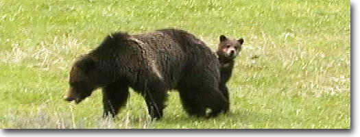
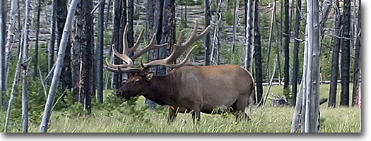
This area also is a refuge for wintering
big-game animals, including mule deer, elk, bighorn sheep and predators
such as the mountain lion and coyote. Even during the summer, there
are telltale signs of their presence. Droppings, patches of shed winter
coat, dropped antlers and overgrazed vegetation all are signs of their
stay.
Most of the valley forms a tight gorge
with fairly steep walls beginning at Cottonwood Creek. This is known
as the Black Canyon because of the darkness produced by the close canyon
walls. Cottonwood Creek is a popular campsite and a good first-day hike.
Little Cottonwood Creek also is a good campsite, with a spring nearby.
But use a water filter before drinking any water, and make sure you
have plenty of good drinking water for this journey.
The Blacktail Deer Creek Trail (see Blacktail
Deer Creek River Trail,for description) joins the Yellowstone River
Trail at the suspension bridge and at the 9.0-mile marker. The river
can be exited from this point, but it is a 1,078-foot, 3.4-mile climb
to the Blacktail Trailhead.
The next landmarks are Crevice Creek
and just beyond Knowles Falls, at the 10.75-mile mark. Do not expect
another Lower Falls. The river is constricted through rock formations
and only produces a 15-foot plunge. Even so, the force and power is
impressive. From Knowles Falls,
the landscape becomes even more desert-like, and the possibility of
seeing snakes increases. Bull and garter snakes are common, and it is
possible-though not highly probable-to find a rattlesnake, so take precaution
when hiking this trail. The trail
emerges at Gardiner, just north of the Yellow-stone Bridge in the downtown
area.
Lost Lake-Petrified Tree Trail
Length: 3.1 miles, loop via
Lost Lake and Petrified Tree.
Length from Roosevelt Lodge to:
Lost Creek Falls (spur trail) 0.25 miles
Lost Lake 0.8 miles
Petrified Tree 1.8 miles
Tower Ranger Station (via Petrified Tree) 2.7 miles
Elevation change: Trailhead at 6,340 (460-foot gain).
Trailhead: The trail starts behind Roosevelt Lodge. Or, as an alternate
route, start at the Petrified Tree, about a quarter mile east of the
Blacktail Plateau Drive exit or about 1.4 miles west of Tower Junction.
The trail begins directly behind Roosevelt
Lodge. It crosses a footbridge and over a wet seep shrouded with ferns.
From there a short spur trail leads
to Lost Creek Falls, a 40-foot plunge into a steep, dark, timber-covered
canyon. From the junction to Lost Creek Falls, the trail climbs south
up a steep 350-foot rocky rim. On the bench above the rim, the trail
then joins the horse trail and continues west to Lost Lake and Petrified
Tree. The trail east heads to Roosevelt Corral and approximately 2.5
miles to Tower Campground (see Roosevelt-Tower Trail for description).
In 1975, an earthquake with an epicenter
near Norris Geyser Basin shook the Yellowstone region. It brought down
delicate spires in the Grand Canyon, and along this rim, large rockfalls
tumbled down the canyon, nearly striking passing hikers.
The trail continues along the shore of
Lost Lake, where beaver activity usually can be spotted. In late June
through early July, the edges of this lake are covered with the arrow-shaped,
leather-like leaves and yellow, baseball-sized flowers of yellow pond
lilies. The trail follows the drainage of Lost Lake through Douglas
fir and aspen, and emerges at the Petrified Tree parking area.
The Petrified Tree has a substantial
iron fence that was installed in 1907 for its protection. At one time,
there were several trees in the vicinity, with broken remnants scattered
on the hillside, but collection and souvenir hunters removed these piece
by piece, including a whole fossilized tree. The remaining tree is a
siliceous replica-a fossil-of an ancient redwood. To
continue back to Roosevelt Lodge, the trail climbs the hill at the northeast
end of the parking area. (For winter skiing, the short spur road to
Petrified Tree is unplowed, and access to this trail and parking is
at the turnout on the Mammoth-Tower Road.) From the parking area, this
trail leads over the saddle between two hills and behind the Tower Ranger
Station and through the Park Service employee-housing area to the cabins
at Roosevelt Lodge. The trail emerges at Hamilton General Store.
Yellowstone River Picnic Area Trail
Length from Yellowstone River
picnic area to:
Calcite Springs View 1.0 miles, one way.
Four-way junction 2.0 miles, one way.
Bannock Ford (spur trail) 2.4 miles, one way. Return to picnic area
4.0-mile loop. Elevation change: Trailhead at 6,200 feet (414-foot gain
to The Narrows viewing area).
Trailhead: Located at the Yellowstone River picnic area, a mile north
of Tower Junction on the Northeast Entrance Road.
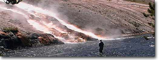
This trail is a short easy hike and provides
wonderful views of Calcite Springs, the narrows of the Yellowstone,
the Overhanging Cliff, the towers of Tower Falls, the basalt columns
and the historic Bannock Indian Ford. It also offers views of the Tower
General Store and the Tower-Canyon Road, and provides access to the
Specimen Ridge Trail (see Specimen Ridge Trail for description) above
the Bannock Ford. From the picnic
area, the trail heads south and parallels the Yellowstone River. The
trail runs very close along the river canyon, and drop offs are common
near the trail. Take precautions while hiking this stretch of the trail.
Bighorn sheep occasionally are spotted
in this area during early spring and fall, as they migrate to and from
the high country in the Washburn area. The primary trees along the rim
are Douglas fir, limber pine and Rocky Mountain juniper.
The trail meets a four-way junction,
the southern trail leads to the Bannock Indian Ford. The eastern trail
leads to Specimen Ridge, a long, hot and grueling hike to the petrified
forest. The northern trail leads directly to the Northeast Entrance
Road and emerges at the glacier exhibit turnout. This is the continuing
trail for the loop hike, but it is not highly recommended because the
return route follows the road for the last mile. The recommended route
is to return on the same trail from the four-way junction. The Bannock
Indian Trail, branching south at the four-way junction, descends steeply
to the bottom of the Grand Canyon at Tower Falls. The Great Bannock
Trail crosses the Yellowstone at the point of a small island. Indians
used this ford during their migrations until the 1870s, at which time
early trappers and explorers began to use it. John Colter also is credited
with using the ford during his historic 1807-1808 winter trip through
Yellowstone, even though his exact route has never been known.
The trail meets a four-way junction,
the southern trail leads to the Bannock Indian Ford. The eastern trail
leads to Specimen Ridge, a long, hot and grueling hike to the petrified
forest. The northern trail leads directly to the Northeast Entrance
Road and emerges at the glacier exhibit turnout. This is the continuing
trail for the loop hike, but it is not highly recommended because the
return route follows the road for the last mile. The recommended route
is to return on the same trail from the four-way junction.
The Bannock Indian Trail, branching south
at the four-way junction, descends steeply to the bottom of the Grand
Canyon at Tower Falls. The Great Bannock Trail crosses the Yellowstone
at the point of a small island. Indians used this ford during their
migrations until the 1870s, at which time early trappers and explorers
began to use it. John Colter also is credited with using the ford during
his historic 1807-1808 winter trip through Yellowstone, even though
his exact route has never been known.
Trout Lake
Length: 0.5 miles, one way.
Elevation change: Trailhead at 6,800 feet (ISO-foot gain).
Trailhead: The trailhead is located on the west side of the Northeast
Entrance highway, about 1.3 miles south of Pebble Creek Campground or
17.5 miles northeast of Tower Junction, The trailhead is unmarked, but
there is a vehicle turnout.
Trout Lake is known for its excellent
fishing, but also is a great short hike. The
trail begins from the turnout and immediately begins a steep climb,
with switchbacks, over a small ridge covered with Douglas fir and lodgepole
pine. At the top of the ridge is a large Douglas fir and the first view
of Trout Lake. At the outlet is an eight- to nine-foot dam constructed
between 1919 and 1950 when Trout Lake, then known as Fish Lake, operated
as a fish hatchery. Originally, cutthroat trout were spawned here but,
by 1934, rainbow trout were planted to provide eggs for other park lakes.
By the early 1940s, rainbow-cutthroat hybrids were discovered, and the
lake was opened for fishing in 1994. The
lake water is clear and only 17 feet at its deepest, but dense aquatic
vegetation grows around the edge, making it difficult to catch the large
trout that abound here. Ducks also prefer this shallow lake, rich in
aquatic food. A perimeter trail crosses the outlet and also leads to
Buck and Shrimp lakes which contain few, if any, fish. From
Trout Lake are great views of The Thunderer (10,554 feet) to the east,
past open meadows to Mt. Hornaday (10,036 feet) to the north and Druid
Peak (9,583 feet) to the west, just beyond the immediate rocky cliff.
|