%20of%20hikinglakebar.JPG)
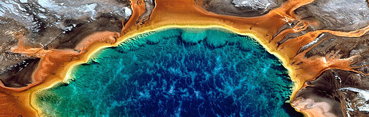
Yellowstone Lake is Yellowstone National Parks largest lake, covering
136 square miles and boasting 110 miles of shore-line. For its elevation,
it is the second largest freshwater lake in the world, the first being
3,200-square-mile Lake Titicaca on the Bolivia-Peru border. The region south of Yellowstone Lake constitutes
one of the largest roadless wilderness areas outside of Alaska and Canada.
This region is accessible only by foot.
 The
primary hiking destination in the Lake area is Pelican Creek drainage.
Pelican Creek played an important roll in the 1877 flight of Chief Joseph
and his Nez Perce (pronounced Nay Per-say) people from the U.S. Army
commanded by Maj. Gen. 0.0. Howard. The Nez Perce split into two groups
just before reaching Pelican Creek, where they eluded Howard's men.
Most of the group, including women and children, proceeded up Pelican
Creek and out the northeast corner via the dark's Fork, while
a band of braves diverted Howards men north through Hayden and Lamar
valleys. The braves then made their escape through the northeast entrance
as well, and regrouped, leaving Gen. Howard behind. But as Chief Joseph
struck north, heading for Canada, he slowed his group near the Milk
River in present day Montana, believing that he was across the Canada
border. Meanwhile, Gen. Miles and his Fifth Infantry, coming from the
east, intersected Chief Joseph. Gen. Howard caught up with the fleeing
Indians and Gen. Miles. Outnumbered, Chief Joseph was forced to surrender
in Montana on October 5, 1877-between the Bear Paw Mountains and the
Milk River-after three months of pursuit. The
primary hiking destination in the Lake area is Pelican Creek drainage.
Pelican Creek played an important roll in the 1877 flight of Chief Joseph
and his Nez Perce (pronounced Nay Per-say) people from the U.S. Army
commanded by Maj. Gen. 0.0. Howard. The Nez Perce split into two groups
just before reaching Pelican Creek, where they eluded Howard's men.
Most of the group, including women and children, proceeded up Pelican
Creek and out the northeast corner via the dark's Fork, while
a band of braves diverted Howards men north through Hayden and Lamar
valleys. The braves then made their escape through the northeast entrance
as well, and regrouped, leaving Gen. Howard behind. But as Chief Joseph
struck north, heading for Canada, he slowed his group near the Milk
River in present day Montana, believing that he was across the Canada
border. Meanwhile, Gen. Miles and his Fifth Infantry, coming from the
east, intersected Chief Joseph. Gen. Howard caught up with the fleeing
Indians and Gen. Miles. Outnumbered, Chief Joseph was forced to surrender
in Montana on October 5, 1877-between the Bear Paw Mountains and the
Milk River-after three months of pursuit.
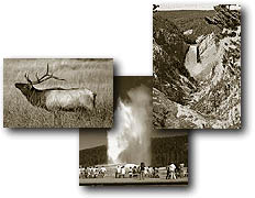
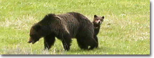
Pelican Valley also is known for its
open, tranquil valley and abundant wildlife especially grizzly bears,
bison, coyotes and birds of prey. Other
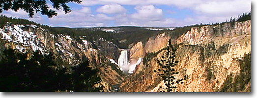
hikes lead to mountaintops offering unparalleled views of Yellowstone,
or to natural bridges, lakeshores or backcountry lakes.
Natural Bridge
Length: 1.15 miles, one way.
Elevation change: Trailhead at 7,737 feet (103-foot gain).
Trailhead: Located 2 miles south of Lake Hotel Junction on the Lake-West
Thumb Road. The trailhead is just south of Bridge Bay bridge, near the
Bridge Bay Campground.
Until the early 1990s, the Natural Bridge
was accessible by car. It since has been barricaded and is approachable
only by foot or bicycle for visitors, making it one of the few, but
extremely short, bicycling routes in the park. Two
approaches are possible. The first is from the highway just south of
the Bridge Bay bridge, at the barricade. From there, it is a good bicycle
trip or a foot walk down the straight lodgepole-lined, paved road to
Natural Bridge. The other route is from the campground. The trail starts from campsite A50 and skirts the western
edge of Bridge Bay before merging with the paved road. The Natural Bridge
was discovered during the 1871 Hayden
Survey and aptly named for this natural feature. The bridge has a span
of about 30 feet and rises about 10 feet above the creek. The top of
the arch is about 40 feet above the creek.
Early Corps of Engineers Superintendent
Hiram Chittenden, responsible for the construction of the Grand Loop
Road, proposed to build a highway over the arch. Because of revenue
restrictions, though, this was never accomplished.
Elephant Back Mountain Trail
Length: 3-mile loop.
Elevation change: Trailhead at 7,800 feet (800-foot gain).
Trailhead: Elephant Back Mountain Trailhead is on the west side of the
Grand Loop Road, about a mile south of Fishing Bridge junction.
The trailhead for Elephant Back Mountain
is about a mile south of Fishing Bridge junction or a mile north of
Lake hotel. It also is easily accessed by foot from Lake Lodge. From
the lodge cut northwest through the trees and across the Grand Loop
Road to the trailhead.
This is a great hike for those staying
in the Lake area and wanting an overview of Yellowstone Lake. The trail
begins in the trees, then splits-take the trail to the right-and ascends
a fairly steep climb of 800 feet, whereupon the view opens up to a spectacular
vista of the Lake development, Yellowstone Lake and the Absaroka Range.
The trail then continues down and merges near the trailhead to form
a loop.
The Hayden Expedition named Elephant
Back Mountain in 1871 for its resemblance to the creature, as formed
by "the almost vertical sides of this mountain, and the rounded
form of the summit."
Pelican Creek Nature Trail
Length: 0.5 miles, one way.
Elevation change: Trailhead at 7,750 feet (No substantial elevation
change).
Trailhead: Located about 1.5 miles east of Lake Junction on the East
Entrance Road at Pelican Creek bridge.
The Pelican Creek Nature Trail-outside
of the Mt. Wash-burn Trail-is one of the most rewarding hikes for its
length in Yellowstone. It is especially rewarding as a dawn or evening
hike. The trailhead is located
at a turn out just southwest of the Pelican Creek bridge. The trail
actually follows Pelican Creek to the inlet of Yellowstone Lake. From
the trailhead, the trail crosses a marshy area via a wooden boardwalk,
then crosses a lodge pole forest and ends at the obsidian-sand beach
of Yellowstone Lake. While walking along Pelican ;;l§i Creek, keep an
eye out for otters If II that frequent this section of the river. Ducks,
too, can be found dipping or diving along this stretch. At the inlet
are several sand spits, which can either be slightly submerged or above
water, depending on the level of the lake. This area is a favorite for
pelicans-the namesake given to the Creek by the 1864 James Stuart prospecting
party-cormorants, and common mergansers. From this point, evening light
and sunsets are especially enchanting, and photographic opportunities
are unmatched.
Storm Point Trail
Length: 1.6 miles, loop.
Elevation change: Trailhead at 7,760 feet (21-foot gain).
Trailhead: The trailhead is located 2.8 miles east of Lake Junction
on the East Entrance Road at the Indian Pond (formerly Squaw Lake) parking
area.
Storm Point is a good, short, early or
late day stroll to a vantage point overlooking Yellowstone Lake and
shore. Mornings and evenings generally are calmer, as mid-afternoon
winds from the southwest race across the lake unabated, producing choppy
water with frothy white caps. The wind then funnels through Mary Bay,
to the east, and becomes even more violent.
During the mid-1980s, the University
of Michigan explored the bottom of Mary Bay using a tethered submersible
camera mounted in a small vacuum-cleaner-sized submarine. What they
discovered at the bottom of the bay were hot springs bubbling through
the sandy bottom and aquatic creatures nearly twice their normal size
for a mountain lake. Deeper in the lake, they discovered geysers that
erupt just as their land counterparts do.
The flat meadow just before the lake
is renowned for its wildlife. Several dusty or muddy, dish-shaped, barren
patches in the meadow are used by bison, or buffalo, as wallows. Grizzly
bears also frequent this meadow, especially in early spring. Elk and
occasionally moose utilize the meadow in the fall.
On this site on July 28, the 1871 Hayden
survey arrived at Yellowstone Lake. "The entire party were filled
with enthusiasm," wrote Ferdinand Hayden, the expedition leader,
in his journal. The party set up camp on the quiet waters of Mary Bay
and proclaimed it "one of the most beautiful scenes I have ever
beheld.... The great object of all our labors had been reached, and
we were amply paid for all our toils."
Turbid Lake Trail
Length: 3.0 miles, one way.
Elevation change: Trailhead at 7,800 feet (37-foot gain).
Trailhead: Located at the Pelican Creek Trailhead at the end of a short
service road. The turn off for this road, 3.2 miles west of Lake Junction,
is across from Indian Pond (formerly known as Squaw Lake).
Turbid Lake is a relatively shallow,
143-acre lake. It was named by members of the 1878 Hayden Survey for
its murky, frothy, tan waters. Springs under the lake bubble constantly,
producing the turbidity. The lake water also is very acidic and, for
this reason, is void offish and other aquatic life. The shoreline also
is barren of green vegetation.
The trailhead for this unusual lake begins
across from Indian Pond. A dirt road angles off the north side of the
East Entrance Road and dead-ends at a barricade after about 0.2 miles.
The trail begins behind the barricade and follows the old service road
due east to Turbid Lake. The trail is an easy hike, skirting the edge
of a large meadow in the beginning, then entering a dense forest. The
trail eventually emerges at the southwestern shore.
This area is well-known for its wildlife,
as bison usually inhabit the small meadow openings. Grizzlies, too,
occasionally are seen wandering through this region; in fact, one even
mauled a hiker here in 1986, so be alert.
Avalanche Peak Trail
Length: 2.5 miles, one way.
Elevation change: Trailhead at 8,466 feet (2100-foot gain).
Trailhead: The trailhead is located about 0.75 miles east of Sylvan
Lake, or just west of Eleanor Lake, on the East Entrance Road. Coming
from Cody, the trailhead is 0.4 miles west of Sylvan Pass. An unmarked
trail climbs steeply from the road.
There is no designated parking, but the
trail begins across the road from the picnic area at the west end of
Eleanor Lake. The Avalanche Peak
Trail is one of the best summer hikes, but because of its elevation
and its heavy snow accumulation in winter, it usually is not accessible
until after mid-July. By then, the snowfields have receded and subalpine
flowers are in full bloom.
The trail to Avalanche Peak historically
has been a very popular trail, providing a magnificent view of the western
landscape of the park. But the trail has never been an official Park
Service trail and today remains an unmarked-but well-worn-path that
winds its way to the summit. Through the years, the Sierra Club, has
maintained the trail, and it is perhaps one of the cleanest trails in
the park.
From the highway, the trail begins a
steep 2100-foot ascent through a dense spruce and fir forest, and a
series of switchbacks to the 10,566-foot summit. Near the summit, the
trail becomes faint in the scree slope, and route-finding becomes necessary. Avalanche Peak straddles the western boundary
of the Park and the terrain to the east is in the Shoshone National
Forest.
Thorofare Trail
Length from Thorofare Trailhead to:
Clear Creek - 2.6 miles, one way.
Elk Point - 3.1 miles, one way.
Park Point - 6 miles, one way.
Signal Point - 7.1 miles, one way.
Columbine Creek - 9.8 miles, one way.
Terrace Point - 14.5 miles, one way.
Cabin Creek/Trail Creek junction - 19.6 miles, one way.
Mountain Creek - 24.5 miles, one way.
Thorofare Ranger Station - 31.0 miles, one way.
South park boundary - 32.0 miles, one way.
Bridger Lake - 33.0 miles, one way.
Elevation change: Trailhead at 8,085
feet (227-foot loss).
Trailhead: Located ten miles east of Lake Junction on the East Entrance
Road and a half mile east of the entrance to Lake Butte Road. The small
trailhead is nothing more than a turnout just south of Lake Butte.
The Thorofare Trail probably is the most
extensive trail in Yellowstone and reaches into the remote center of
the largest wilderness in the lower 48 states. But because of the distance
and remoteness, few venture into this pristine region. Those who do
access it primarily from the south, through the Teton Wilderness and
Two Ocean Plateau, and usually by horseback. Extensive planning is needed
to arrange for trailhead transportation, food (or food caches) and appropriate
gear for extended trips.
Nonetheless, the Thorofare Trail is not
a strenuous trail. It mainly follows the east shoreline of Yellowstone
Lake and the slow, meandering inlet of the Yellowstone River. With a
few minor ups and downs, the trail is relatively flat. In
spring and early summer, the greatest hazards are the streams and creeks
near their inlets to the lake. They generally are swollen with snowmelt
and usually have breached their banks. Only a few makeshift fallen-log
bridges cross these streams, and crossing or fording these streams otherwise
is extremely dangerous.
The eastern shore of Yellowstone Lake
also is known for some of the best fishing in Yellowstone. Several of
the points- Elk, Park, Signal or Terrace-are legendary for being some
of the best. The Thorofare Trail is an old and well-established trail, probably originating as a game trail,
later used by Native Americans, trappers and even later by early expeditions,
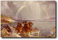
including the historic 1871 Hayden Survey. Artist Thomas Moran and photographer
William H. Jackson accompanied that expedition, capturing some of the
first images of this region of the park. Many of the peaks and monuments
to the east echo the names of many of those early expedition leaders,
including Mt. Doane (10,656 feet), Mt. Stevenson (10,352 feet), and
Langford Cairn (8,842 feet).
The upper Yellowstone River is a remote
wilderness in itself. The meandering river, with its broad, willow,
sedge- and rush-filled, marshy valley provides ideal habitat for moose,
waterfowl and grizzly bears.
In the upper Yellowstone basin are several
access trails. One is the Trail Creek Trail, which originates at Heart
Lake Trail (see Heart lake Trail for description) and follows the bottom
of the south and southeast arms of Yellowstone Lake before emerging
with the Thorofare Trail at the Cabin Creek patrol cabin. Another trail
from the west is the South Boundary Trail (see South Boundary Trail
for description). This trail joins the system at the Thorofare Ranger
Station.
From the Thorofare Ranger Station, near
the south boundary in the southeast corner of the park, are a number
of trails leading in other directions. This is considered the crossroads
of the Two Ocean Plateau and Thorofare regions, and trails merge and
diverge south, west and east from here, leading to Bridger-Teton National
Forest and Grand Teton National Park.
Bridger Lake lies just south of the boundary
and is a legendary landmark for early fur trappers. Another interesting
feature south of Bridger Lake on the Continental Divide is Two Ocean
Creek. It is one of two streams in North America-the other is in Canada-where
a bizarre phenomena occurs: The
stream flows downward and splits in half, one half flowing east to the
Atlantic Ocean and the other half flowing to the Pacific Ocean.
|