Daly
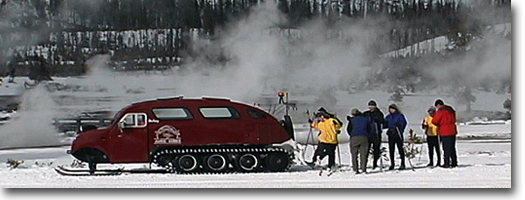
Creek - Lava Butte Trail Daly and Black Butte creeks are located in an isolated region in the extreme northwest comer of Yellowstone. This area is a popular hiking destination for residents of Big Sky and Bozeman, Montana, as well as a starting location for horsepackers heading into the more remote regions of the Gallatin Range. Daly Creek is a smaller version of the large, open sweeping landscapes of Yellowstones interior valleys. Open, grassy slopes with rock escarpments, fringed with Douglas firs and aspen dominate most of the hillsides up this valley. After about a mile, the trail junctions to the east and the trail proceeds up-slope to cross through a pass before descending into Black Butte Creek. Near the pass, on an alternate side trail, is the Daly Creek patrol cabin, used by Park Service personnel for private parties. Black Butte Creek is a narrow valley, heavily treed with aspen, Douglas fir and lodgepole pine. The trail follows the creek along the southeast base of Lava Butte and emerges onto the highway about 1.3 miles from the trailhead. Bunsen Peak Trail The trailhead is about five miles south of Mammoth at the summit of Golden Gate-just where the road levels out on Gardners Hole-and above Rustic Falls. The Bunsen Peak Loop Road starts on the south side but the dirt road often is barricaded. Parking is available at the turnout, and the trail starts just past the barricade. The ascent of Bunsen Peak is a relatively modest climb. It begins among singed sagebrush and enters charred skeletal remains of Douglas fir and lodgepole pines that were burned during the 1988 fires. As the trail becomes steeper, it begins a series of switchbacks and offers excellent views of Mammoth Terraces to the north and Mount Everts to the east of Mammoth. Members of the Hayden Survey named the dome-shaped Bunsen Peak in 1872, in honor of Robert Wilhelm Eberhard von Bunsen (1811-1899), eminent German physicist, inventor and chemist. His name is attached to the Bunsen Burner, even though he did not invent it. He conducted extensive studies of Iceland's geysers and developed an original theory regarding their function, and he is honored here for this hydrothermal work. From the summit of Bunsen, you can view the Mammoth area and the Absaroka Range to the north. Electric Peak to the northwest, Gardner's Hole-including Swan Lake Flat-to the southwest, and Arrow Canyon and the Washburn Range to the southeast. At the summit are a number of electronic towers, repeating stations, TV towers, an electronic shed and antennas, along with discarded cables and other rubbish. This equipment is for Park Service employees and provides FM radio, a government radio repeater station and television for Mammoth residents. From the summit, the trail continues on and down the east slope of Bunsen Peak. It emerges near the Osprey Trailhead. But because of the one-way road, it is a difficult a dusty route to return to the point of origin. Snow Pass Trail The trailhead and parking area for Snow Pass begins at the same location as the Bunsen Peak Trailhead. For Snow Pass, however, cross the highway and follow what appears to be a dirt road heading north and following Glen Creek upstream. It is recommended that you start here because it is downhill to Mammoth. But for cross-country skiing, you can approach it from either direction. From the trailhead, the trail follows the northern edge of Gardners Hole at the base of Terrace Mountain (8,011 feet). After about two miles is a four-way junction in the open meadow. The trail to the west is the Fawn Creek Trail (see Fawn Pass Trail for description). Straight north are the Sepulcher and Electric peak trails. The trail to the east leads to Snow Pass and, ultimately, to Mammoth. After crossing Snow Pass (7,450 feet), the trail descends steeply nearly 1,200 feet to Mammoth (6,239 feet). About a third of a mile past the pass is another junction. The trail to the north, or left, leads to Mammoth and junctions with the Sepulcher Mountain Loop Trail after a mile. From there, it follows Clematis Creek east and emerges between Liberty Cap and the stone house in Mammoth. The other trail at the junction just off the pass leads due east and emerges onto the highway, just above the Upper Terraces. This is the preferred trail for cross-country skiers because Mammoth generally is snow-bare most of the winter. But heavy snow accumulation usually starts at this elevation. During winter, the road is barricaded above the Upper Terraces and only snowcoach and snowmobile travel are allowed beyond the parking area into the park. Wraith Falls Trail This is a short, easy hike to an 80- to 100-foot cascade on Lupine Creek. The creek slides down a large rock sheet in a setting of large lodgepole pines, Engelmann spruce and Douglas firs. But the area immediately surrounding the falls burned during the 1988 fires; charred timber is all that remains of a once lush, old-growth forest. The trail begins in an open, exposed sagebrush-sedge meadow and meanders into the woods. The rushing water of the cascade often is audible before it is actually seen from a hillside lockout point downstream. Geologic members of the Hague party named the falls in 1885. Wraith means ghost, or the apparition of a living person, but it is unknown whether that meaning was applied in its naming. In the nearby woods are Sheepeater wickiups-tipi-like structures composed of sticks and poles. Only a few remain in Yellowstone, and none have been found in the interior of the park. This falls can also be accessed by cross-country skiing in winter, though snow conditions can be icy and change abruptly between open meadow and shaded forest. Maneuvering in the forest also is difficult, and the creek bottom generally has a greater snow load from moisture and protection. Through most of the winter and early spring, the falls or cascade is shrouded in snow and ice.
|