%20of%20xcountrybar.JPG)
Ice Lake Trail
Length from Ice Lake Trailhead to:
Ice Lake - 0.3 miles, one way
Wolf Lake - 4.0 miles, one way
Elevation change: Trailhead at 7,800 feet (80-foot gain).
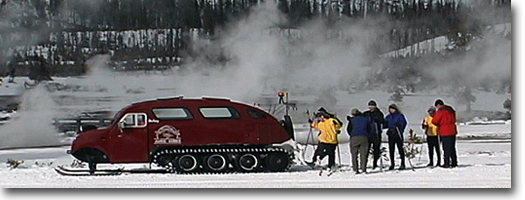
Trailhead: The trailhead is 3.25 miles east of Norris Junction on the
Norris Canyon Road, and the parking area is an unmarked turnout near
the exit of the Virginia Cascades road.
The trail is relatively flat and very
short, only a 10- to 15-minute hike from the trailhead. The lake itself
is lined with subalpine fir and lodgepole pine, but the 1988 fires have
affected some areas. Another approach
to Ice Lake is via the Norris Campground trail, which is about 4.3 miles.
The trail-head is located in the east central edge of the campground.
After about a half mile the trail
junctions and the southern trail crosses Solfatara Creek, then continues
through lodgepole pines, and a meadow before reaching the north side
of Ice Lake. Ice Lake and nearby Wolf and Grebe lakes are the headwaters
of the Gibbon River, which flows past Norris Geyser Basin and merges
with the Madison River at Madison Junction. Ice Lake is fed by underground
springs and seepage. Fish have been unable to establish in the lake,
even though massive stocking efforts between 1905 and 1961 released
nearly 4 million graying, brook trout, cutthroat trout and rainbow trout.
Because there is not a constant flowing inlet and outlet, conditions
are poor for spawning, leaving the lake barren offish.
During winter, the 224-acre lake freezes
over, but not solid. Only the first one to two feet of the 53-foot deep
lake freezes; on top of that, four to six feet of snow can accumulate,
making the lake appear as a large white field. It was named Ice Lake
circa 1900 because nearby Norris Hotel cut its ice supply from this
small lake.
On the northwest side of the lake the
trail joins the Howard Eaton Trail and continues east to Wolf and Grebe
lakes. But the Gibbon River will need to be forded several times before
reaching Wolf Lake. This lake is smaller-just a quarter of the size
of Ice Lake-but maintains a good population of rainbow trout. They were
introduced, along with graying and cutthroat, during the 1920s and 30s.
The trout began to hybridize and, by 1969, only rainbow-trout characteristics
were found. The large, open, marshy
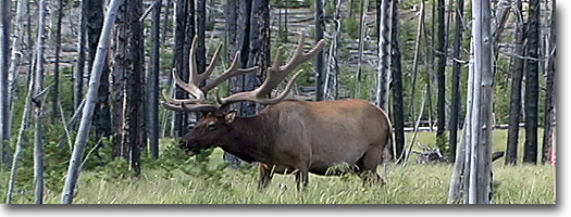
meadows bordering the northwest and southeast shores of Wolf Lake often
are occupied by moose, sandhill cranes (in the spring), or great blue
herons.
Norris Geyser Basin Trail
Length from Norris parking area to:
Porcelain Basin - 1.6-mile loop.
Back Basin - 2.0-mile loop.
Elevation change: Trailhead at 7,520 feet (40-foot gain).
Trailhead: Located at the Norris Geyser Basin parking area.
This is an exciting and easy hike into
an austere but colorful geyser basin. Two trails loop through the basin:
The northern loop explores Porcelain Basin; and the southern, longer
trail loops through the Back Basin.
Norris Geyser Basin was named after an
early Yellowstone superintendent, P.W. Norris, and this basin may be
the hottest geyser basin in Yellowstone. The Carnegie Institute of Washington,
D.C. made testwells in 1929 to determine subsurface temperatures. One
test hole was abandoned at 265 feet, when the temperature reached 401
°F and the steam pressure threatened to destroy the drilling rig.
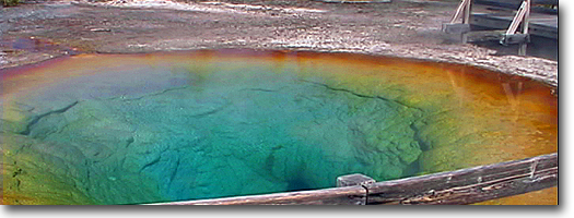
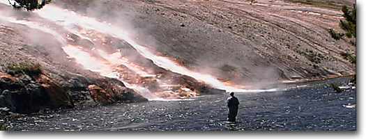
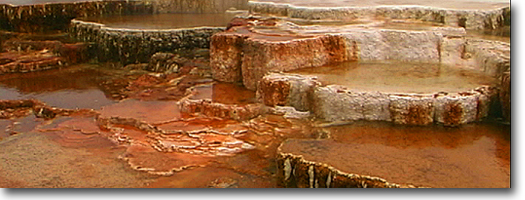
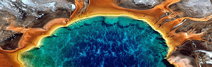
The stark, barren landscape of Porcelain
Basin is the result of an acidic environment. Because of this hostile
condition, plants, algae and bacteria have difficulty establishing themselves.
Instead, the basin derives its colors from mineral oxides, in spectrums
of pink, red, orange (iron oxides) and yellow (sulfur and iron sulfates). The acidic water also has created changes
in the formation of sinter deposited around vents. Silica deposits as
tiny, sharp spines instead of thick, beaded deposits common in more
alkaline basins.
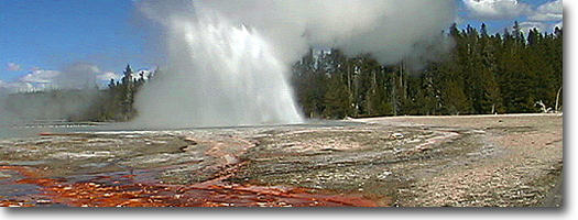
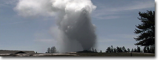
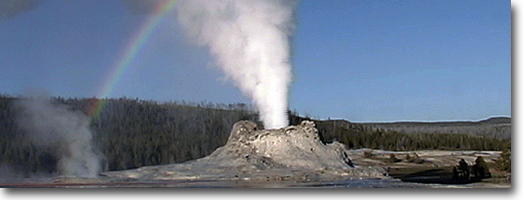
The Back Basin has the worlds largest
geyser, but plays at irregular intervals. Steamboat Geyser has long
periods of dormancy, but when it does erupt, it sends jets of water
nearly 380 feet high in a spectacular display. Echinus Geyser is the
largest predictable geyser at Norris. Before an eruption, water usually
fills the basin to within two or three feet of the rim and begins boiling.
Churning and splashing then trigger an eruption, throwing water and
steam upward in a series of explosive bursts. After an eruption, the
basin drains, producing a whirlpool and a gurgling that sounds as if
a stopper from a bathtub had been pulled.
Solfatara Creek Trail
Length: 6.1 miles, one way, to Norris Campground.
Elevation change: Trailhead at 7,400 feet (84-foot loss).
Trailhead: The best entrance for a one-way, downhill hike is to start
13.5 miles south of Mammoth (or 7.1 miles north of Norris Junction).
A small, circular parking area on a short service road, east of the
highway, marks the trailhead. It is a one-way hike, and a car shuttle
is required, but the trail does end at the Norris Campground.
From the start, the trail enters the
lodgepole forest; to the south, up a small, steep drainage, is Amphitheater
Springs. The trail then wanders directly beneath a powerline for a good
third of the hike, but the powerline is visible for most of the duration.
The trail illustrates a common concern and a lack of proper trail placement
in recent years. In the past few decades, many of the trails have been
aligned in the path of powerlines- or, in some cases, powerlines have
been erected following traditional trails. The Solfatara Trail is no
exception. A 50- to 60-foot-wide swath has been cut out of the forest
to allow for potential falling trees to clear the powerlines. The 1988
fires burned along this trail, and gallant fire-fighting efforts to
wrap the power poles in aluminum foil saved some, but many burned. After
the 1988 fires, the lines were restrung, but many of the powerlines
could have been buried and a wiser, esthetic, ecological, and environmental
approach could have been pursued. No plan or suggestion was made. It
was purely cost and profit that motivated the reconstruction of existing
lines and the cutting of swaths through pristine, virgin forest for
new connections. The effects of the 1988 fire can be found along this
trail. Chain-saw cut, burned trees
testify to the widening of the swath to protect the powerline.
After about a mile, Lake-of-the-Woods
becomes visible through the burned trees to the northeast. It is possible
to bush-whack directly to the lake from the trail, but an easier route
is to continue down the trail until it separates from the powerline.
A faint game trail then doubles back along the outlet to the lake.
A short distance beyond the stream crossing
is a cluster of extinct, dormant, and some active thermal springs, called
Whiterock Springs. Most of the area is acidic and barren of vegetation.
It resembles a moonscape. In one area is a small algal-bacteria filled
lake that bubbles and froths.
The remaining trail wanders through meadows
and along Solfatara Creek. The word Solfatara is from an Italian
origin that means "a volcanic vent, from which only sulphurous
exhalations and aqueous vapours are emitted," and these vents often
have a greenish tinge due to the combination of algae. Solfatara Creek
is fed by thermal springs, and sulphur-loving bacteria line the stream.
During summer, they react to the bright sunlight and become bright green.
Shortly before reaching Norris Campground
is a trail junction that leads to Ice Lake (see Ice Lake Trail for description).
From the junction, it is only slightly more than a half mile through
lodgepole pines to the campground, and the trail emerges in the east
central edge.
Artist Paint Pot Trail
(Gibbon Geyser Basin)
Length: 0.75 miles, loop.
Elevation change: Trailhead at 7,355 feet (55-foot gain).
Trailhead: The parking area and trailhead is a wide spot on the
road, located 4.1 miles south of Norris Junction.
The Artist Paint Pots are the most popular
feature of the Gibbon Geyser Basin. They are isolated in the lodgepole
forest at the end of a three-quarter-mile-loop hike. The
group was named after the pastel multicolored mud pots. Iron oxides
have tinted white siliceous mud various colors of pastel beige, pink
and slate. The thickness of the mud varies from season to season. In
spring and fall, the mud pots are thin and soupy, and the mud bubbles
and boils. By late summer, the mud pots thicken and may hurl hot mud
10 to 15 feet into the air. Mud cones also will form when the mud is
thick, only to dissolve into mud pots when excess moisture is present.
The trail then emerges into a desolate
geyser basin. Several cylindrical cones dominate the basin. Most are
dormant, except Monument Geyser, also called Thermos Bottle. It is a
IO-foot-tall cone formed in a thermos bottle shape, with a narrow diameter
vent. It is a steady geyser but ejects very little water. It does, however,
emit a constant, low hissing sound. Because of its height and age. Monument
Geyser is sealing its vent with internal deposits of sinter. Several
nearby cones already have sealed their vents and thus have become extinct
geysers. Army Park Superintendent P.W. Norris named these features in
1878.
|